Bringing spatial data to the scale of entire buildings
.png)
Spatial data at scale

Naturally, without any specific context, the term 'spatial data' brings to mind satellite imagery or the technical vocabulary of astronomy. Even at this level, we are dealing with two very different scales.
On one hand, we have the vastness of the Universe, where distances are measured in astronomical units or light years. On the other, we have the Earth’s surface as observed from space, where we measure in kilometers or meters. The orders of magnitude, resolution, and data density are radically different.
In terms of resolution, consider the latest satellites (Pléiades Neo Next by Airbus for instance), they capture images where a single pixel represents just 20 cm on the ground. At that level of detail, it is practically possible to count the plates on your garden table from orbit
A shift in scale: From Territory to Building
The observation of Earth from the sky or space—alongside the work of cartographers—enables the collection of spatial data, often referred to as geographic data. This information is stored in Geographic Information Systems (GIS). Whether used for urban development, infrastructure management, environmental protection, or health crisis simulation, this data is expressed within perfectly defined frames of reference. This has given rise to specialized fields ranging from geodesy (the science of measuring the Earth) to geomatics (the processing, storage, and visualization of geographic data).
For 40 years, GIS has linked geography with data so effectively that the term 'spatial data' has become synonymous with it. To be precise, we should perhaps call it 'geospatial data.'
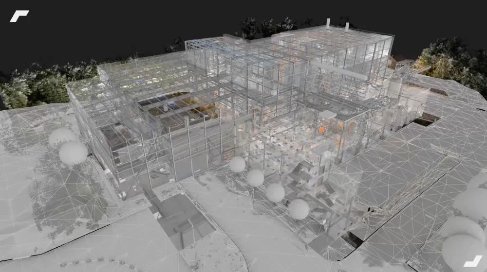
Today, I am proposing a new use of the term” spatial data ” on a scale that is still different from those mentioned above. What if we increased our resolution from meters to centimeters, crossed the threshold between 'outside' and 'inside,' and plunged into the buildings themselves? Buildings are as much a part of our environment as any object in a GIS. In fact, France already has a massive, open GIS describing 32 million structures: the BDNB (National Building Database), the first large-scale GIS focused specifically on the building level.
An extension to indoor GIS: spatial continuity
Crossing a building's exterior walls—its envelope—to navigate the interior with the same logic of positioning used at a geographical scale is equivalent to extending GIS to indoor spaces. This continuity of navigation brings the principles of geodesy into the architectural universe, extending geodetic systems inside the building itself.
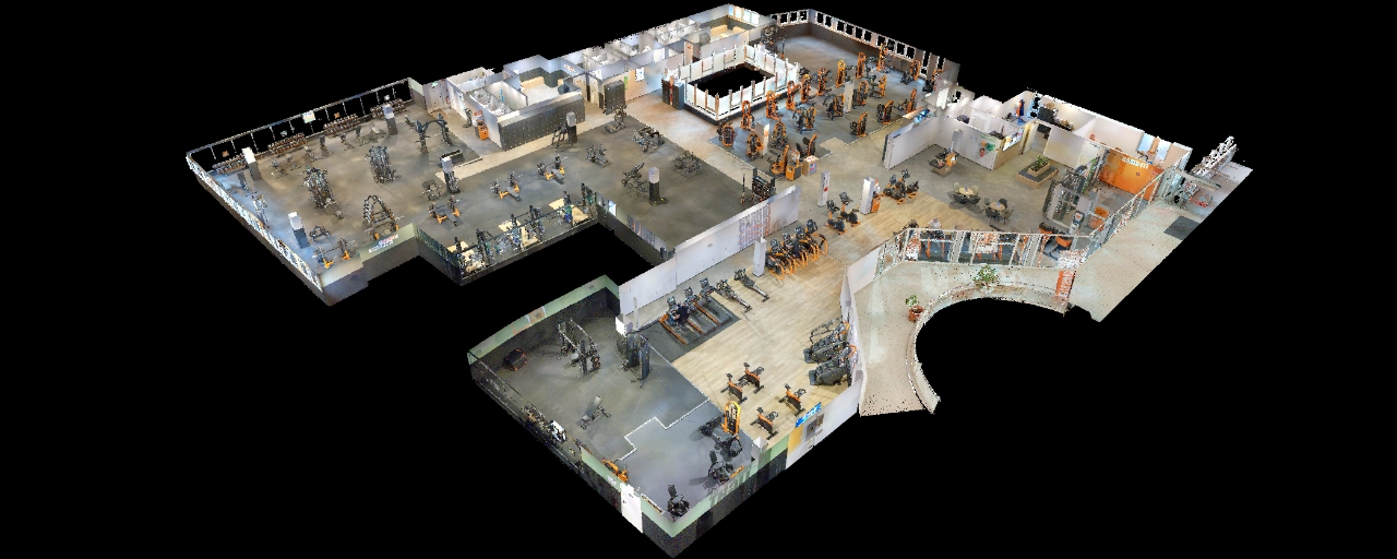
Just as a city street has a 'street furniture' layer where every object—manhole covers, utility poles, and underground networks—has precise geographical coordinates, so too does every element of a building. This includes both the structural elements (walls, partitions, doors, windows, and frames) and the internal assets (furniture, machinery, MEP networks, and sensors). Each has a position in space precisely defined within a spatial coordinate system. By extending georeferencing to these components, we create what can be termed 'Indoor GIS.'
By extension, I propose that in architecture, spatial data refers to any information related to the position, shape, size, or arrangement of elements within or around a building. More broadly, it encompasses any data point whose location in space is known and expressed in a local or absolute coordinate system—such as a physical measurement captured by an IoT sensor.
At My Digital Buildings, we go a step further, categorizing all representations that form a building’s digital twin as 'spatial data':
- 2D plans;
- 3D models (BIM);
- Panoramic photos that make up a virtual tour;
- Multimodal replicas, such as 3D thermal infrared views.
Let's study your project together
Contact us, we will study your project to provide you with an estimate as soon as possible
Contact us


To make sure you don't miss out on our news, subscribe to our newsletter now!
Receive quarterly updates directly in your inbox to stay informed about the latest news and events at My Digital Buildings.


