EDF - 5 fully digitized hydraulic power plants

The framework of the project

At the gateway to Oisans in Isère, in a narrow valley, EDF carried out the largest hydroelectric project in France. More powerful, better integrated into the landscape and respectful of the environment, new underground equipment has replaced 6 power plants and 5 dams in the Romanche Valley that have become obsolete.
The history of the valley has been marked by the production of electricity, nothing more normal than the Department of Isère for a long time involved in its unique industrial heritage, EDF and the Community of Communes de l'Oisans wanted to preserve the memory of this unique place before it was dismantled.
In 2020, under the impetus of the Oisans Community of Municipalities, the partners came together to build this original digital archive project. The merger with French Tech in the Alps, and more particularly with the Terrains Solutions project, made it possible to identify the right actors.
What solution did these three actors in the territory choose for the “digital” conservation of the Romanche Valley before this page of history was turned?
A startup from the Grenoble region, My Digital Buildings was commissioned to produce an interior and exterior digital duplicate of five of the six power plants to be dismantled. These 3D replicas of reality, real digital avatars, will serve to preserve memory but also to feed the various initiatives to promote heritage. These could take shape in surrounding museums dedicated to hydroelectricity or local heritage, in projects for thematic viewpoints or information points on cycling or walking routes.
A comprehensive multi-technology survey
The scanning solutions used
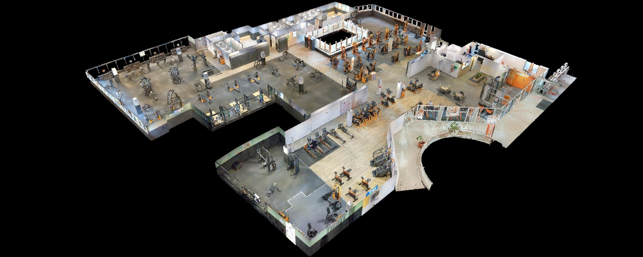
To capture reality, My Digital Buildings used two techniques: 3D survey by laser scanner (lasergrammetry) and 3D photo survey (photogrammetry). In addition, hundreds of panoramic photos were taken on each site to allow, when the day came, to deploy virtual tours and relive the places as if we were there.

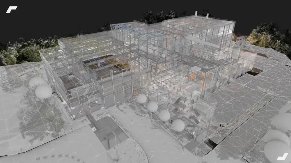
On the one hand, drones flew over the sites to take photos of the facades and roofs, on the other hand, static and mobile 3D laser scanners were used to freeze the interiors and the direct surroundings of the buildings.
The choice of drone photogrammetry for exteriors was obvious, as the roofs were not accessible for an operator and the facades were too high to be fully raised with a 3D laser scanner.
For the interior, combined with Mobile scanner (here a NavVis M6) and a Static scanner (here a Faro X130) allowed us to make the most of each of the equipment, namely the speed of capture of the NavVis M6 and the longest range of static scanners. Thus, we identified the large spaces of the power plants (halls with turbines and generators, workrooms, corridors, etc.) with a mobile scanner, which allowed us to cover a lot of space in a minimum of time.

The datasets were then completed and their assembly facilitated by static scanner stations, which were easier to implement in areas that were more difficult to access or congested (stairwells, narrow spaces around turbines, etc.). For precise and optimal alignment of the various data sets, temporary targets were deployed in and around the buildings. These targets were identified with the various equipment.

The Capture Summarized in a Few Figures
- 5 hydroelectric power plants identified in 3 days
- 3 drones and 2 laser scanners
- 1.4 TB of data collected including
- 6,500 photos of facades and roofs, 120 MB each
- 1,200 32MP HD panoramic interior photos
- 350 fixed laser scanner stations
- 9 hours of dynamic scanner acquisition
- 25 min of 360° movie (shot by helicopter)
Deliverables Opening Up to a Multitude of Uses
Despite difficult weather with regular showers, the team was able to collect quality data in record time. This overcast weather nevertheless had a positive impact: in the absence of marked shadows, the models produced by photogrammetry are perfectly illuminated, they are bathed in a very homogeneous light environment. Browse the two low-definition examples below: the Vernes power plant on the left and the Roberts power plant on the right.
The complete point clouds, virtual tours and textured 3D renderings of outdoor spaces were therefore delivered to the various actors in this project. These deliverables will initially be preserved as a digital archive before being used to enhance the heritage. Several initiatives under development could use this data to “virtually” revive these infrastructures that have marked the history of the valley. It would then be possible to be transported to the past during a visit to a possible future electricity museum or during a stop at one of the thematic viewpoints. In any case, regardless of the use, the data is there and just waiting to come to life.
Testimonial from our customer
In this project, the solution proposed by My Digital Buildings perfectly meets the request to keep the memory of these places and to imagine the renderings to be proposed. We are very happy to have been able to collaborate with a young innovative and local company as part of the Territories Solutions program!
Pierre-Damien Berger - Minalogic - Director MinaSmart EDIH Europe and Head of the Territories Solutions program at French Tech in the Alps Grenoble
Let's study your project together
Contact us, we will study your project to provide you with an estimate as soon as possible
Contact us


To make sure you don't miss out on our news, subscribe to our newsletter now!
Receive quarterly updates directly in your inbox to stay informed about the latest news and events at My Digital Buildings.


