A complete offer to launch
the digitization of your buildings
At My Digital Buildings, we support you in implementing a building digitization process, and exploiting your digital twins.

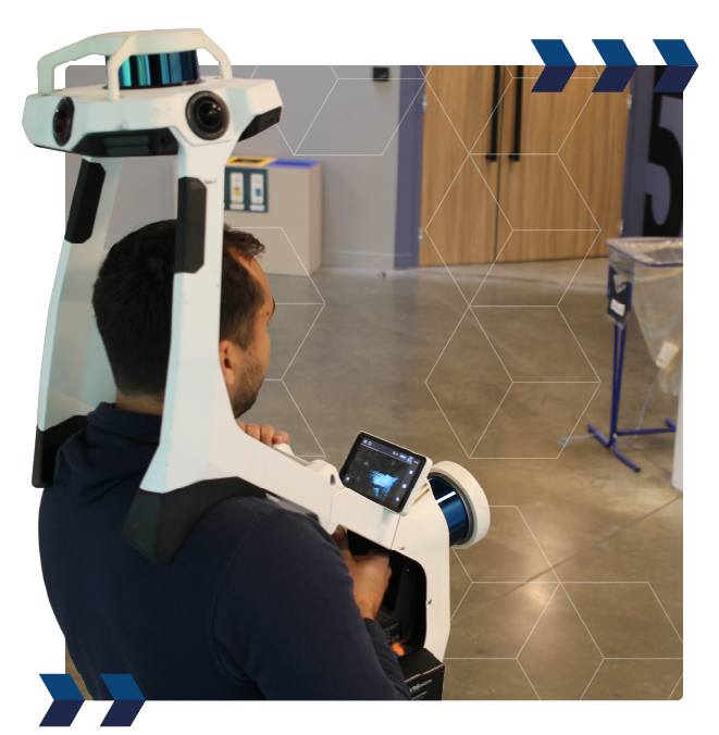
3D Scan
A fast and standardized 3D survey service, regardless of the location of your buildings in Europe.


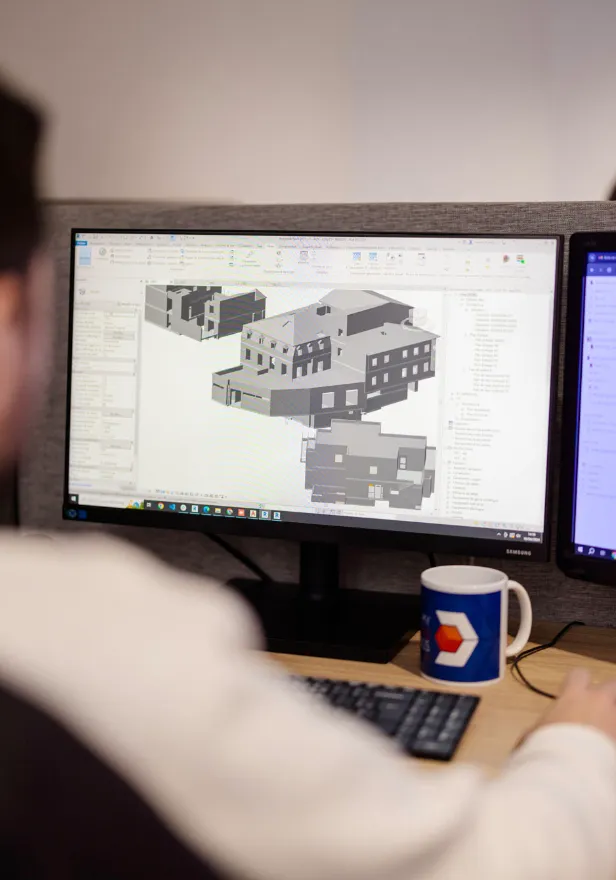
3D models / BIM
3D modeling using a “scan to BIM” process, to benefit from detailed and accurate BIM models.

Support
We develop a customized digitalization strategy, analyze your processes, and provide support tailored to your business needs.

Virtuals visits
Enjoy a complete immersion in your buildings thanks to an interactive virtual tour, offering in-depth exploration and detailed inspection without the need for physical travel.
Entrust your project to building expert


After years of working in 3D data acquisition and processing for both surveying firms and design offices, Mathias launched the My Digital Buildings agency in Béziers.
As a trained topographer and certified drone pilot, he is the ideal contact for all your digitization projects.


Opt for a survey protocol aligned with your specifications, combining the best 3D scanning solutions (static, dynamic and drones) on the market.

To minimize survey time and disturbances, we use dynamic 3D scanners capable of covering 12,000 m² per day.

Collaborate with a local contact to gain responsiveness of intervention and in flexibility on all of your digitization projects.
Your digitization projects:
Operations
To meet the unique needs of your project, we choose and use réactivité d'intervention et en flexibilité sur l'ensemble de vos projets de numérisation.
Pour répondre aux besoins uniques de votre projet, nous choisissons et utilisons the most advanced survey solutions available on the market (drones, static scanners and mobile scanners).
The progress of your digitization projects
Study of your project
Understanding your needs, uses, and studying the buildings concerned by your project.
Framing of expected deliverables
Common framing of expected deliverables, to ensure that they are aligned with your objectives and uses.
Definition of the survey protocol
We select the most suitable survey solutions for your project (static and dynamic scanners, drones, total station).
Survey intervention
3D scanning operation on site, following the protocol established to minimize the disruption of your operation.
Post-processing of captured data
Calculation, cleaning and assembly of point clouds and various data collected on site.
Production of deliverables
Creation of deliverables (2D plans; 3D/BIM model); virtual visit; point cloud) according to the specifications.


Some figures


