Why opt for a multi-technology 3D scanning protocol?


Deploying a hybrid 3D scanning protocol, or “multi-technology”, means jointly using various acquisition solutions (e.g. static, dynamic scanners, drones, etc.) to conduct the 3D survey of a building.
Opting for such an approach will make it possible to define a “tailor-made” capture protocol for your 3D survey project, and to take advantage of the advantages of each of the selected solutions.
Indeed, deploying this type of protocol offers several essential advantages, in particular for:
- Perfectly adapt the 3D scanning protocol to the project specifications and the specificities of the buildings
- Ensure comprehensive data acquisition, covering all areas of the building effectively
- Benefit from an effective survey protocol, without compromising between speed of acquisition and precision
In this article, we invite you to discover these various advantages in detail.
What are the main 3D capture solutions?
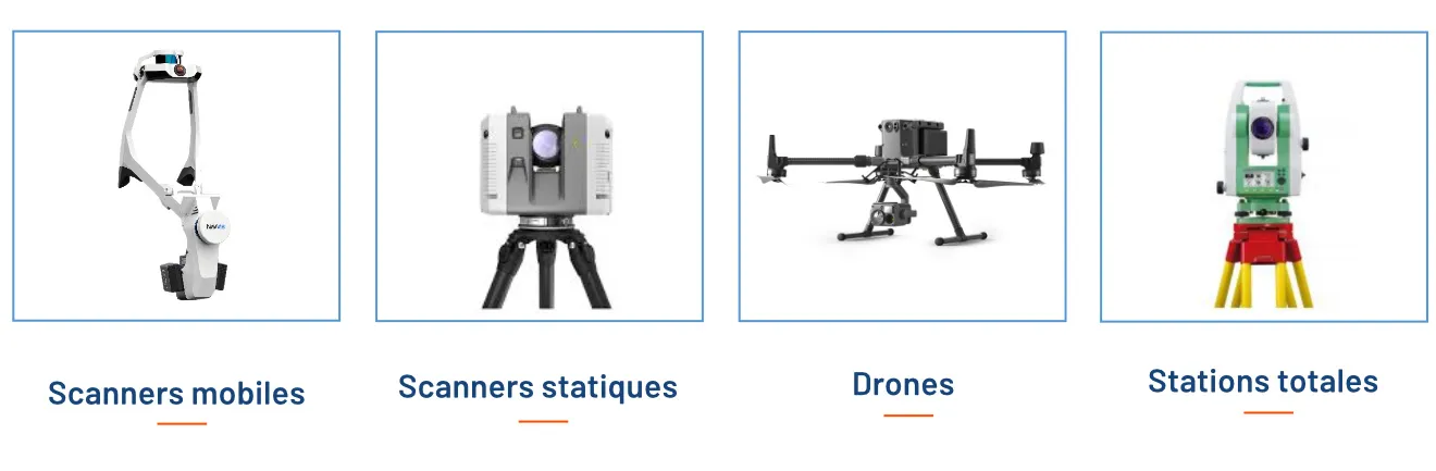
3 main capture solutions that can be deployed to digitize a building: dynamic, static scanners, and drones. In a few words, here are their specificities:
- Dynamic scanners: new generation equipment, they make it possible to digitize a building while moving around it, thus offering a particularly high survey rate. They also allow you to capture a large number of panoramic photos in conjunction with a point cloud.
- Static scanners: traditional scanners mounted on a tripod, making it possible to capture particularly precise and dense point clouds, station by station. Although slower than dynamic scanners, they provide high-resolution scans at specific locations where more detail may be needed.
- Drones, making it possible to conduct photogrammetric or lasergrammetric aerial surveys.
Note that, in conjunction with these solutions, it is common to deploy a total station, making it possible to identify targets or control points to make point cloud processing and assembly more reliable.
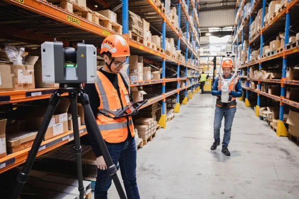
Extensive data acquisition
The solutions mentioned above will be perfect Complementary during the 3D survey of the building. Very generally, it is observed that:
- The mobile scanner will be deployed to quickly acquire the least congested areas where there is no risk of scanner drift. Indeed, dynamic scanners risk “drifting” into areas where few characteristic elements allow the scanner to be located simultaneously with the acquisition (e.g.: repetitive stairwells; long corridors; etc.)
- The static scanner will be used for the acquisition of congested areas, since it is smaller, high facades thanks to its range, high points (when mounted on a tripod), and for all areas where the mobile scanner is not suitable.
- The drone will capture the least accessible areas of a building (extremely high facades, roofs and areas inaccessible to operators) as well as large plots of land.
A fast 3D scanning operation
As explained above, mobile scanners offer a very high reading rate, 3 to 4 times faster than a static scanner. By integrating them into a survey protocol, as far as possible according to the project specifications, the acquisition phase is particularly accelerated.
Conducting a 3D acquisition quickly will allow limit the disturbance what it can cause, what can be crucial in sensitive environments or with high activity (hospitals, industrial sites, sites under construction).
As explained above, mobile scanners cannot be used in all configurations, which is why it is attractive to have other solutions available, such as a static scanner or a drone, to complete the acquisition.
In conclusion, by taking advantage of these 3 solutions, it will be possible to conduct an exhaustive and accurate survey of the building, while optimizing the time spent on site.
An optimized 3D survey, both in terms of costs and time spent
As explained above, the use of mobile scanners makes it possible to drastically reduce the time required for acquisitionn of data compared to the exclusive use of static scanners. This can lead to significant cost savings, especially for large or complex buildings.
This time saving should be put into perspective with the fact that it is sometimes necessary to allocate 2 operators for the use of a mobile scanner (the first one prepares the scanning area, opens the doors and warns the occupants, while the second one is in charge of the 3D acquisition). However, it is clear that the use of dynamic scanners reduces costs of acquisition when we take a 3D survey operation as a whole.
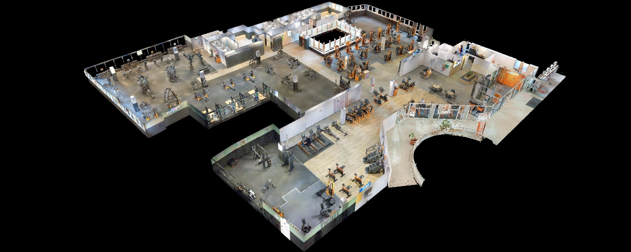
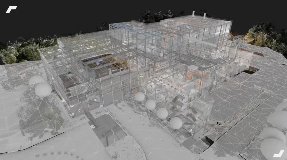
Some typical examples of relevant multi-technology 3D surveys
Common examples of multi-technology surveys include:
- The combined use of a mobile scanner to cover large spaces, a static scanner in congested areas and exterior facades, and a drone to survey roofs and terrain
- The combined use of a mobile scanner in open areas, with that of a static scanner on a tripod to identify high points (e.g.: small networks located high up; upper parts of production lines).
Note that static scanners are regularly used to establish a “skeleton” of the building by noting the facades, surroundings and stairwells, to which will be attached the point clouds recorded with the dynamic scanner.
In conclusion
Overall, combining several capture solutions during a building survey will make it possible to take advantage of the strengths of each solution, and dEstablishing a customized survey protocol.
Multi-technology surveys allow for faster data acquisition, optimal accuracy, and greater flexibility. Well controlled, they guarantee results in one complete and reliable data set for your projects.
Let's study your project together
Contact us, we will study your project to provide you with an estimate as soon as possible
Contact us


To make sure you don't miss out on our news, subscribe to our newsletter now!
Receive quarterly updates directly in your inbox to stay informed about the latest news and events at My Digital Buildings.


